3D laser scanning
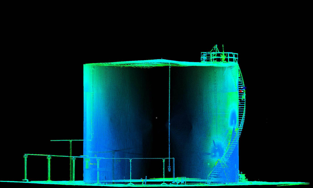
Besides land surveying and dimensioning, Geoservice Landmeetkunde is also an expert in 3D laser scanning. The brand new Trimble TX8 enables us to prepare three-dimensional measurements of objects up to 340 metres with a high level of accuracy (max. deviation 2mm). Due to the speed and accuracy, the demand for 3D laser scanning of systems, premises and storage tanks has risen considerably in recent years. That is why the team of Geoservice Landmeetkunde has specialised in 3D laser scanning.
3D laser scanning for superb geometry
Due to its sophisticated technology, it is hard to imagine geometry today without the 3D laser scanner. The 3D laser scanner measures millions of points and the relevant x, y and z coordinates plus a colour value in a very short spell. A full 3D image is created by positioning the laser scanner in various locations. The image of the relevant object is highly detailed due to the high concentration of points on a surface area.
Applications for 3D laser scanning:
- Changes in reconstructions
- Consequences of system extensions
- Surveying the as-built situation
- Scanning of building construction (BIM)
- Scanning of accident locations
- Volume assessments
- Piping
- Verification measurements
- Architecture
Geoservice Landmeetkunde uses 3D laser scanning technology to draw up very detailed 3D images of premises, storage tanks and systems in a short space of time.
More information on 3D laser scanning:
- Trimble TX8
More information?
Would you like to receive personal advice from our professionals?
Get in touch with us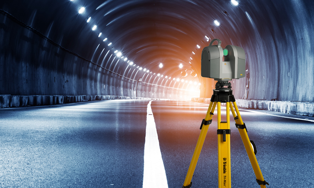 1
1